Project Portfolio
GIS & Spatial Analysis
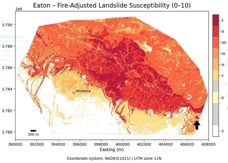
Landslide Susceptibility After Eaton/Palisades Fires
University of Redlands, 2025
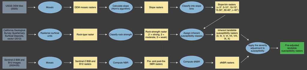
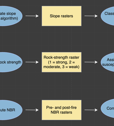
For my final project in GIS 667 (Python for GIS), I developed Python code to conduct an exploratory analysis of landslide susceptibility in the areas affected by the Eaton and Palisades Fires. Using DEM data from the USGS and rock-type data from the California Department of Conservation, I first mapped inherent landslide susceptibility based on the classification used by the California Geological Survey. Then, using Sentinel-2 satellite data, I calculated the change in the Normalized Burn Ratio (NBR) from pre- to post-fire and overlaid it with the inherent landslide susceptibility maps to create a fire-adjusted classification for these areas.
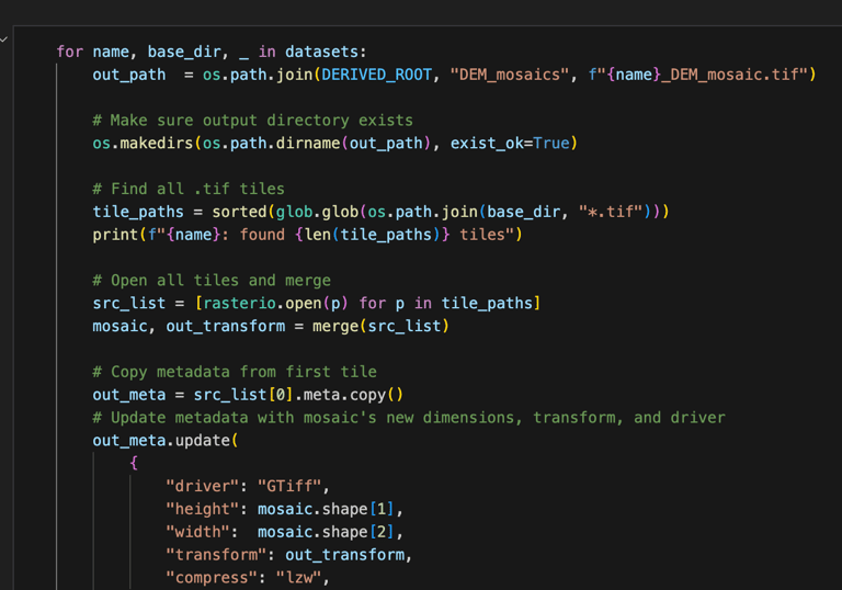
The code for this project did not employ the ArcPy library or the ArcGIS API for Python; instead, it relied on other geospatial libraries, such as rasterio, pyproj, and shapely.